FAQs

Questions and Answers about Burned Area Emergency Response (BAER) Imagery Support and Burned Area Reflectance Classifications (BARC).

,
Fire Damage Assessment

The Burned Area Emergency Response (BAER) program assesses damage to both infrastructure and the environment. Forest lands often provide ecosystem services such as providing clean drinking water for municipal watersheds. BAER teams, assisted by burn severity datasets, identify areas where clean water supplies might be threatened and prescribe treatments to ensure that large volumes of soil and debris do not contaminate the water supply.

,
Flooding Event

A truck moves debris off the road following a flooding event. These types of events are exacerbated by the removal of vegetation and forest duff that both help to absorb moisture into the soil.

,
Hydrophobic Soil

Extreme heat and the loss of vegetative cover can cause soils to turn hydrophobic following a wildfire event, meaning they no longer absorb water but instead repel it. Here a Forest Service soil scientist checks for hydrophobicity. Hydrophobic soils can lead to mud and debris flows during heavy rainfall events.

,
Satellite Imagery

BAER Imagery Support utilizes freely available satellite images such as those acquired through the Landsat and Sentinel missions. By comparing pre and post-fire images, and utilizing wavelengths of light not visible to the human eye, we are able to map the impact of fire on the landscape. In the above Landsat image from the Beaver fire in northern California in 2014, darker colors indicate higher burn severity.

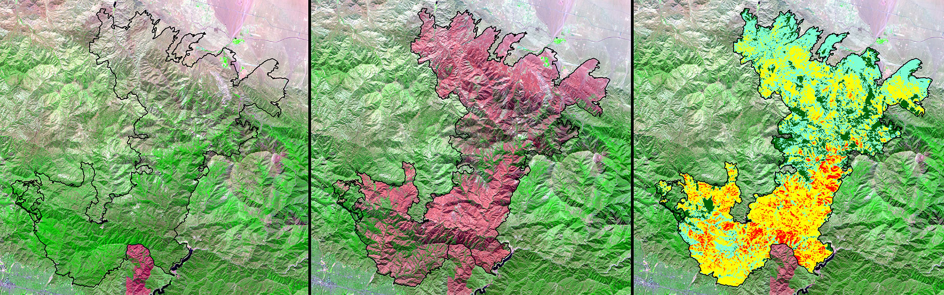
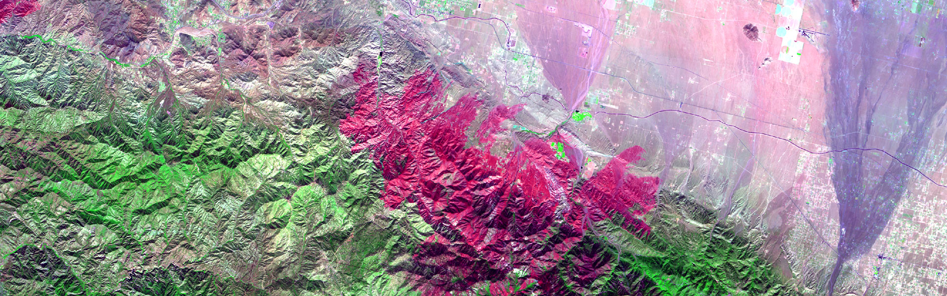
Within 7 days of fire containment, the BAER Imagery Support Program provides satellite images, burn area severity classifications, and other critical data to BAER teams. One of the team's first tasks in the field is to create a soil burn severity map using BARC data provided by the BAER Imagery Support Program.

Request Data
Request Data

To make a request, please use the link below. If not registered already, you will need to do so. In order to efficiently create your request, please have the fo...

Downloads
Downloads

Data for all processed BAER imagery support requests are available here, sorted by year and by geographic region. The BAER Imagery Support program provides a se...

About the BARC
About the BARC

A Burned Area Reflectance Classification (BARC) is a satellite-derived data layer of post-fire vegetation condition. The BARC has four classes: high, moderate, ...