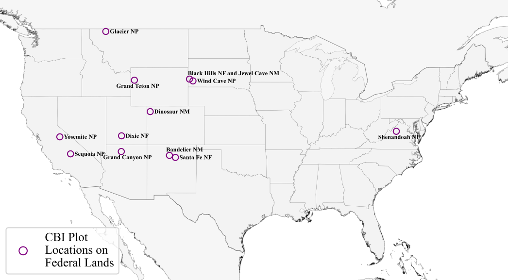
Composite Burn Index Photo Series
The Composite Burn Index (CBI) has been widely used to assess the on the ground burn severity fo many locations within the conterminous United States. Depending on the site's vegetation and how it burned, the same CBI value can visually look very different between sites. To illustrate these visual differences, several regional CBI photo series were developed:
Note: The dimensions of these downloadable PDFs are 22 x 17 inches.
California - Yosemite National Park, Mixed Conifer Forest: Link
California - Southern Sierra Mountains, Sequoia National Forest, Chaparral/Open Conifer Forest: Link
Central - South Dakota, Jewel Cave National Monument, Wind Cave National Park, and Black Hills National Forest, Ponderosa Pine Forest: Link
Northern Rockies - Glacier National Park, Conifer Forest: Link
Rockies - Grand Teton National Park, Sagebrush/Grasslands: Link
Southeast - Virginia, Shenandoah National Park, Deciduous/Conifer Forest: Link
Southwest - Grand Canyon National Park, Mixed Conifer Forest: Link
Southwest - New Mexico, Bandelier National Monument and Santa Fe National Forest, Ponderosa Pine/Mixed Conifer Forest: Link
Southwest - Utah, Dixie National Forest and DInosaur National Monument, Piñon/Juniper/Sage Communities: Link