Prairie Fires
Flint Hills Prairie Fires
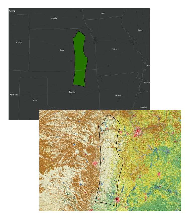
The Flint Hills are one of the most fire prone ecosystems in the United States. Annually, prescribed fires and wildfires can burn hundreds of thousands of acres. The Burn Severity Portal prairie fire products document the annual occurrence and extent of larger prairie fires in the Flint Hills as defined by the U.S. Environmental Protection Agency’s Level III Ecoregions.
The methods used to produce the prairie fires products for the years 2009 to the present are different than MTBS methods. These new methods are optimized to efficiently map and characterize the large number of fires that occur in this region on an annual basis. Prior to this change, modified MTBS fire mapping methods were used. New mapping methods were developed, to address the unique frequency and extent of fire in this prairie biome. Fire products are now delivered through the Burn Severity Portal and are no longer included as part of the MTBS products unless a fire is identified in IRWIN, NFPORS or a legacy federal fire occurrence database. Completeness of Prairie Fire products may vary slightly based on the availability of suitable imagery in the weeks immediately after fire occurrence.
Timeline
1 to 6 weeks after fire containment
Data Access
Data Available
- 2009-2025
- 1986-2025
Audience
This product is intended to address geospatial data and information needs associated with the unique fire regime of the Flint Hills region. Comprehensive annual burned area boundary mapping data for this region are compiled using consistent methods and data sources and provided by a single source.
Mapping Method
- From 2009-present:
- Bands 2-4, 8, 11, and 12 from Sentinel 2 images are input into a model which identifies the break between burned and unburned areas.
- Bands 2-7 from Landsat 5, 7, 8, & 9 images are used when Sentinel 2 imagery is not available to identify burned areas.
- Fire perimeters are created from the burned areas and no manual editing is performed.
- Polygons less than 3 acres are manually removed by analysts.
- Prairie Fire products consist of one multi-part polygon shapefile for each source image date.
- Products are developed by applying a classification tree model on available Sentinel and Landsat imagery for all available image dates with visible fires and with <80% cloud cover in the spring of each year.
- From 1986-2007:
- MTBS methods were used (link to MTBS Mapping Methods) and the products were transferred to the Prairie Fire program in the third quarter of 2024.
- Standard MTBS products are available in addition to the fire perimeter polygon.
Deliverables
- Burned area polygon shapefile for years 2009 and beyond
- Standard MTBS products are available in addition to the burned area polygon for 1986-2007