CBI
Composite Burn Index
The Composite Burn Index was developed by Key and Benson (2006) to assess the on the ground fire effects on vegetation and soil (i.e. burn severity). CBI plots (30m diameter) rate the burn severity for: substrates (litter, duff, fuel, and soil); herbs, low shrubs, and small trees; tall shrubs and sapling trees; intermediate trees; and big trees. Each of these five strata are rated for 4-5 ratings factors that assess burn severity on a continuous scale ranging from 0.0 (unburned) to 3.0 (high severity). Ratings factor values are averaged together to calculate one value for each stratum. An overall CBI value is then calculated by averaging each stratum's value together. Overall CBI values can subsequently be compared with satellite-derived burn severity data to develop regression equations.
Citation:
Key, Carl H.; Benson, Nathan C. 2006. FIREMON - Landscape assessment. Pages LA 1-55 In: Lutes, Duncan C.; Keane, Robert E.; Caratti, John F.; Key, Carl H.; Benson, Nathan C.; Sutherland, Steve; Gangi, Larry J. 2006. FIREMON: Fire effects monitoring and inventory system. General Technical Report RMRS-GTR-164-CD. Fort Collins, CO: USDA Forest Service, Rocky Mountain Research Station.
Timeline
1 month – several years after containment
Learn More
Data Access
Data Available
Data available from 1994 to 2017, and 1/1/1983 ig-date in CBI data refers to “NULL” or “missing fire Ignition date”
Land managers, fire scientists, researchers, modelers, students
Mapping Method

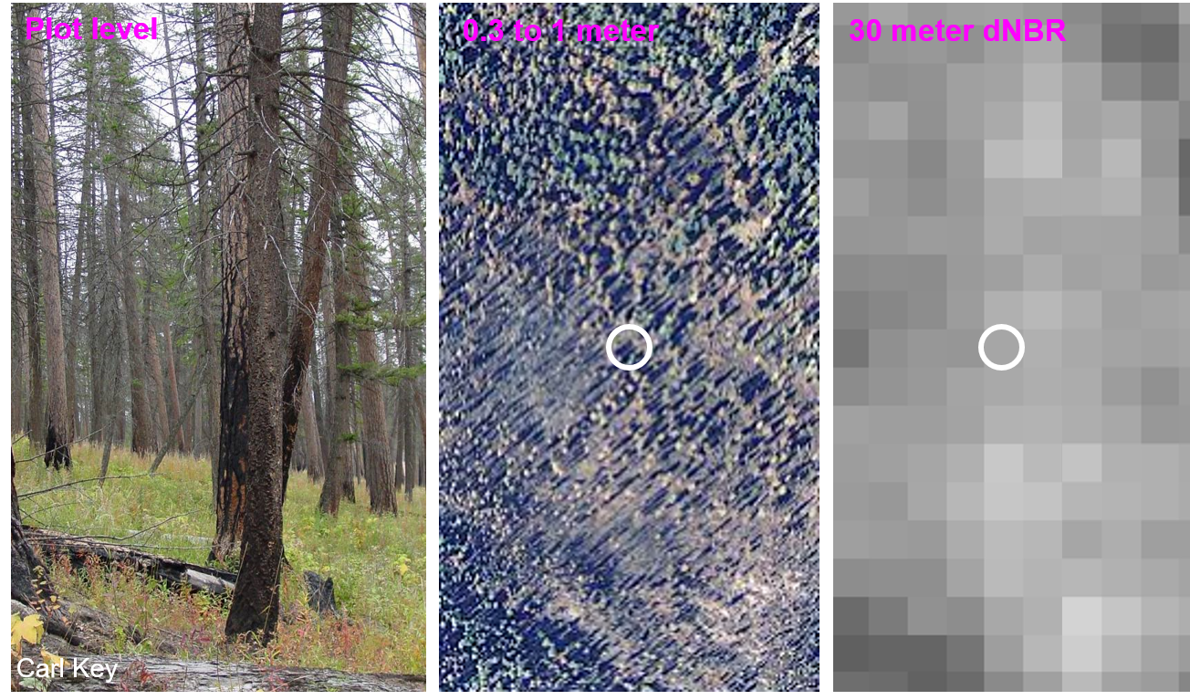
Example of burned area in which CBI analysis was undertaken (Plot level) as compared to 0.3-1-meter-high resolution imagery, and 30 meter differenced Normalized Burn Ratio (dNBR) imagery.
Deliverables

- Direct Download
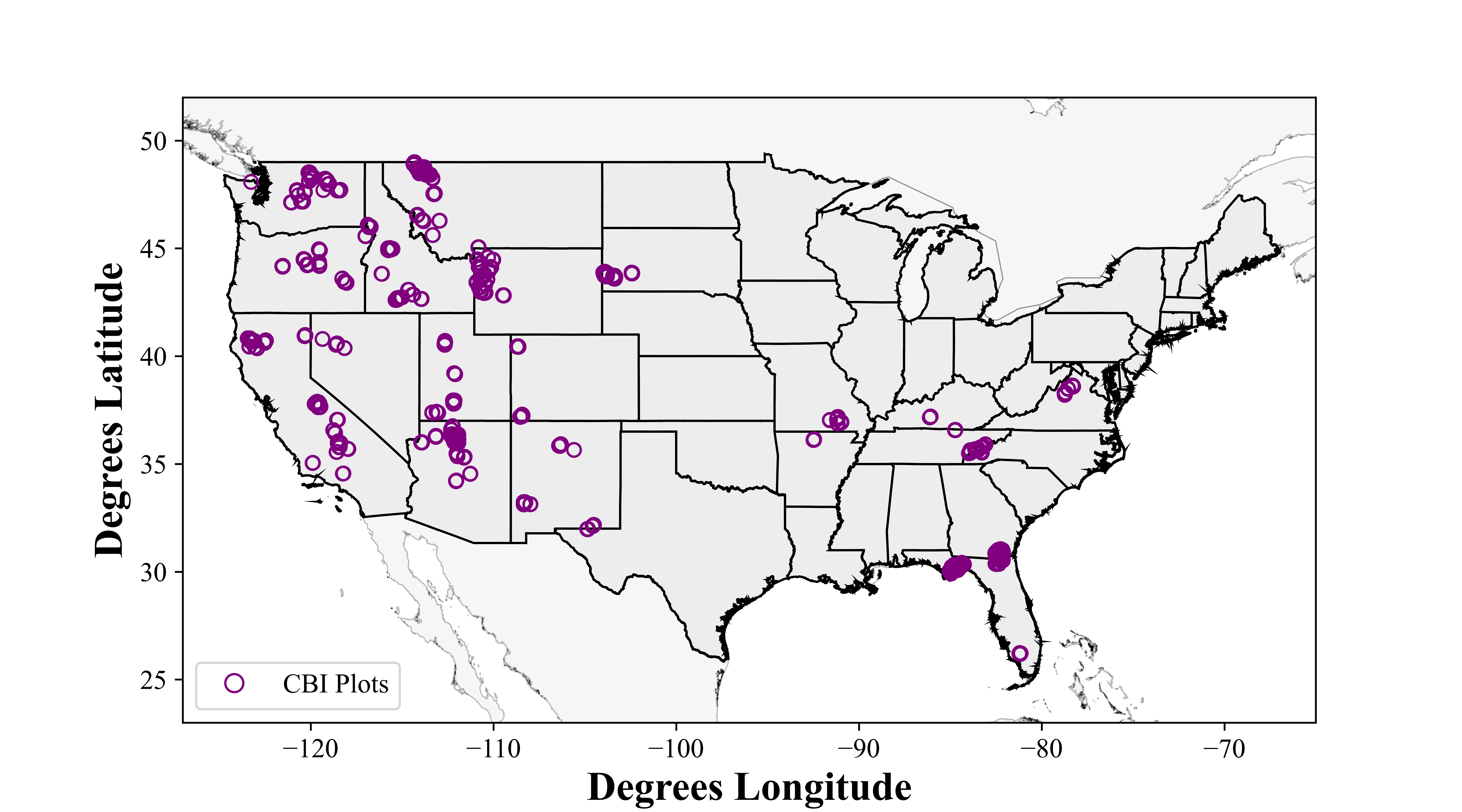
- Single shapefile containing tabular plot information for all CBI plots nationwide
- Interactive Viewer
- Individual shapefiles for each CBI plot containing tabular plot information
- Plot photos included in plot bundle where available