Provisional IA
Provisional Initial Assessments
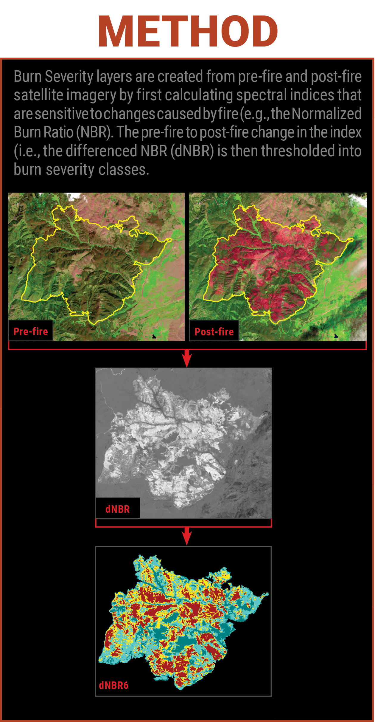
Beginning in 2020 and continuing through the 2025 fire season, a provisional mapping strategy was implemented for fires reported as greater than 40,000 acres in burned area or those considered particularly significant. These assessments, known as Provisional Initial Assessments (PIAs), utilized an initial assessment approach regardless of the vegetation type or density, if suitable imagery was available. For detailed information on methods and criteria, visit MTBS.gov.
Starting with the 2026 fire season, PIAs have been fully integrated into the MTBS program. For further details, please see the MTBS | Burn Severity Portal.
Timeline
Provisional Initial Assessment data became available approximately 3 to 6 weeks after fire containment
Data Access
- Access PIA data through the Interactive Viewer
Data Available
PIA data was available for fire seasons 2020 through 2025.