MTBS
Monitoring Trends in Burn Severity
MTBS consistently maps the location, extent and severity of all large fires occurring in the United States from 1984 to present. Temporally and spatially comprehensive data provided by MTBS supports a variety of policy and resource management information needs.
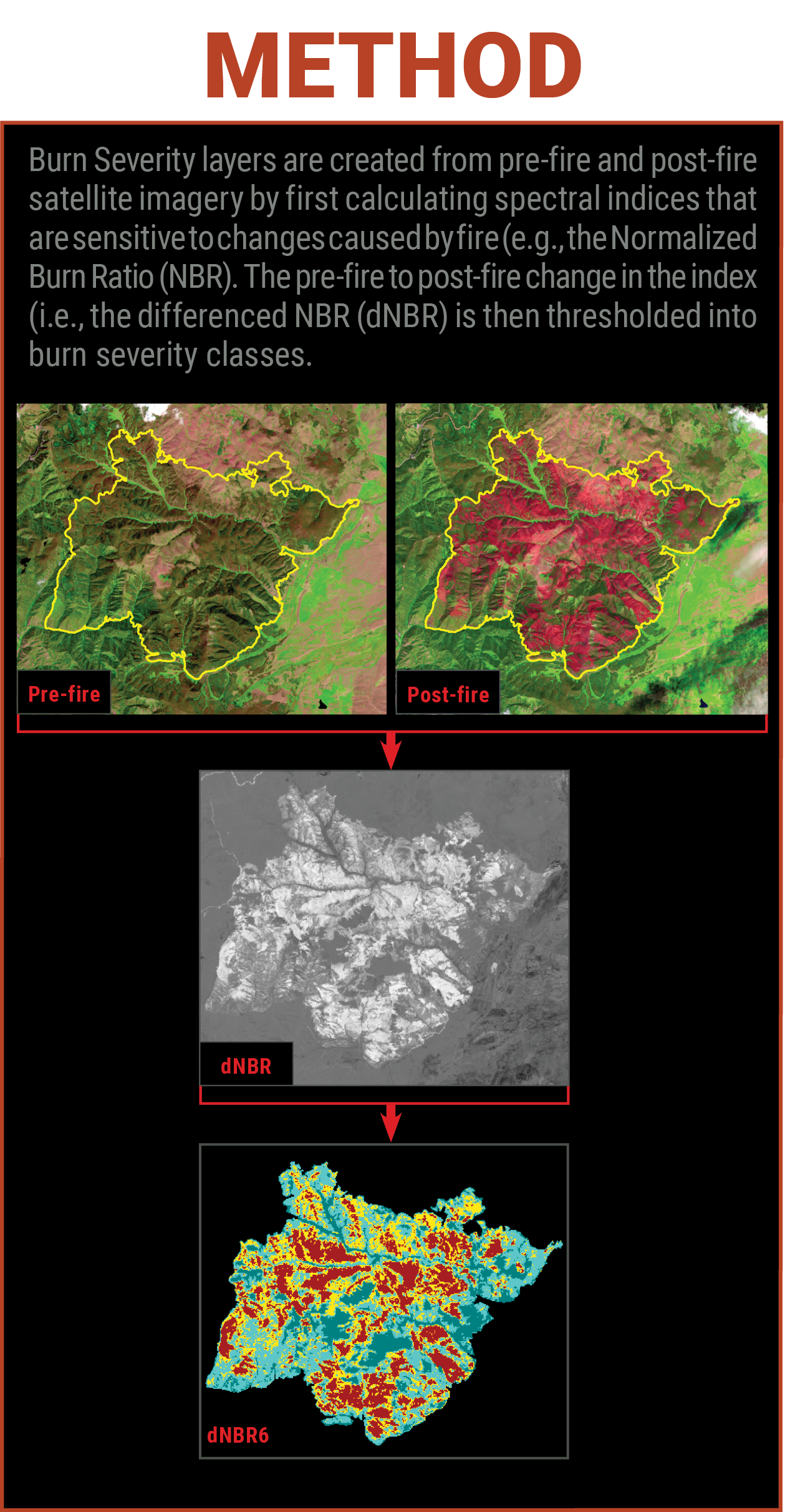
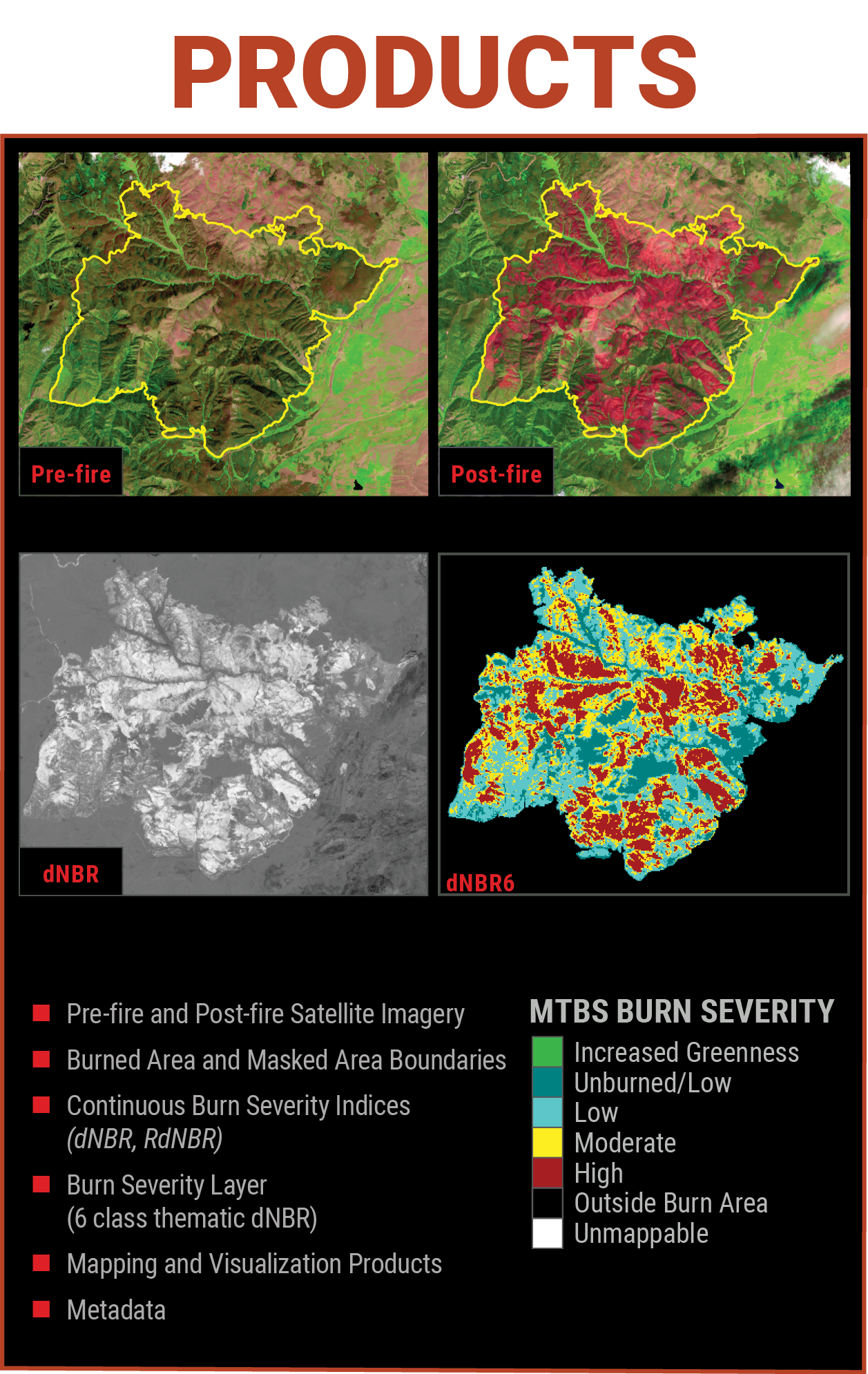
MTBS analysts select pre- and post-fire imagery based on types of assessments that vary by landscape/vegetation type. In grasslands and low biomass shrublands initial assessments are performed which utilize post-fire imagery from immediately after the fire to capture burn severity before rapid post-fire changes occur. In forests and high biomass shrublands, extended assessments are performed which utilize post-fire imagery from the following growing season to capture delayed fire effects.
In 2020, the MTBS program team began creating initial assessments for all fires greater than 40,000 acres to provide severity information sooner for large fires. These assessments were called Provisional Initial Assessments or PIAs. Extended assessments were also created for fires in high biomass systems during the normal MTBS production cycles and are available under the MTBS program.
Beginning in 2026, fires that would have had PIAs due to their size or location, will be mapped and released using official MTBS initial assessment protocols and will be published under that program. Fires in high biomass systems will be assessed and mapped during the extended assessment period. All legacy PIA fire products from 2020-2025 will remain available on the Burn Severity Portal for viewing and downloading under the PIA program. However, the extended assessment products for fires occurring in high biomass systems will be available from MTBS.
Timeline
3 weeks - 12 months after fire containment
Learn More
Data Access
Data Available
1984-2026
Audience
Developed primarily to monitor the effectiveness of national fire management policies, MTBS products are also used to assess the immediate and long term effects of fires on the landscape, as a consistently derived source of fire disturbance data used by national land cover and monitoring programs, as a supplemental information tool to inform operational fire suppression decisions by wildfire managers, and provides a rich and unprecedented dataset for analysis and application by the research community.